PROJECT RESULT SET
Dataset 1
PROJECT 49 · GPS → INSIGHT
Explore how real-world bus GPS traces are processed into smoother driving cycles for fuel-efficiency, congestion, and emissions analysis.
HYBRID MMAS–ABC BUS OPTIMIZATION
01 / LIVE ANALYSIS
PROJECT RESULT SET
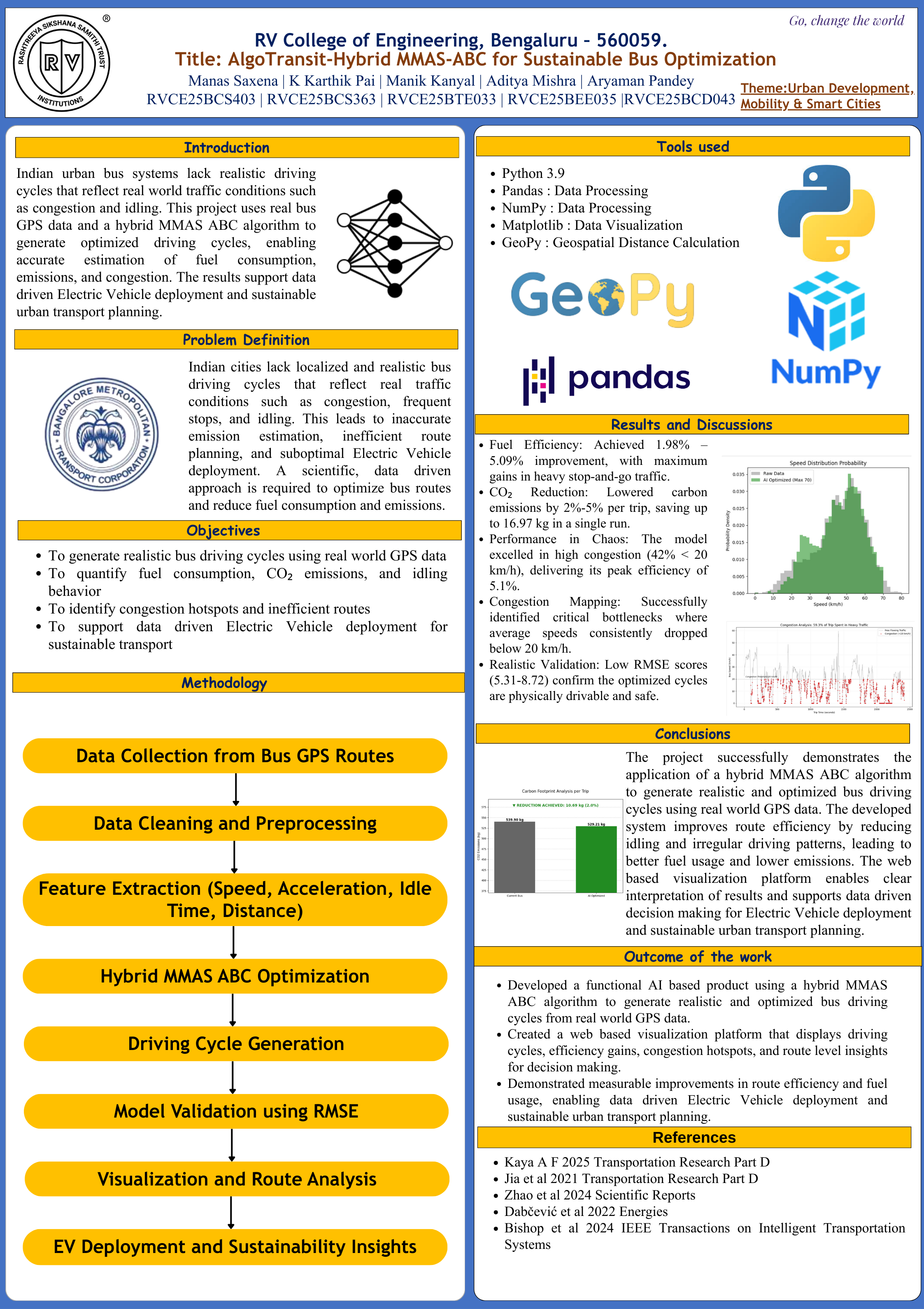
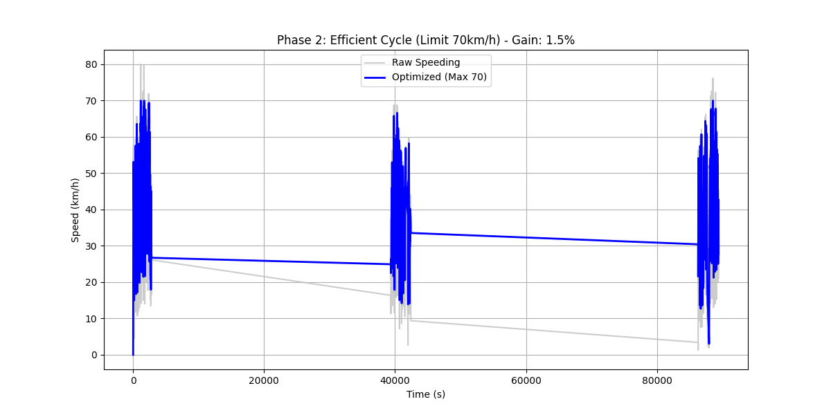
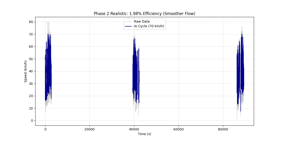
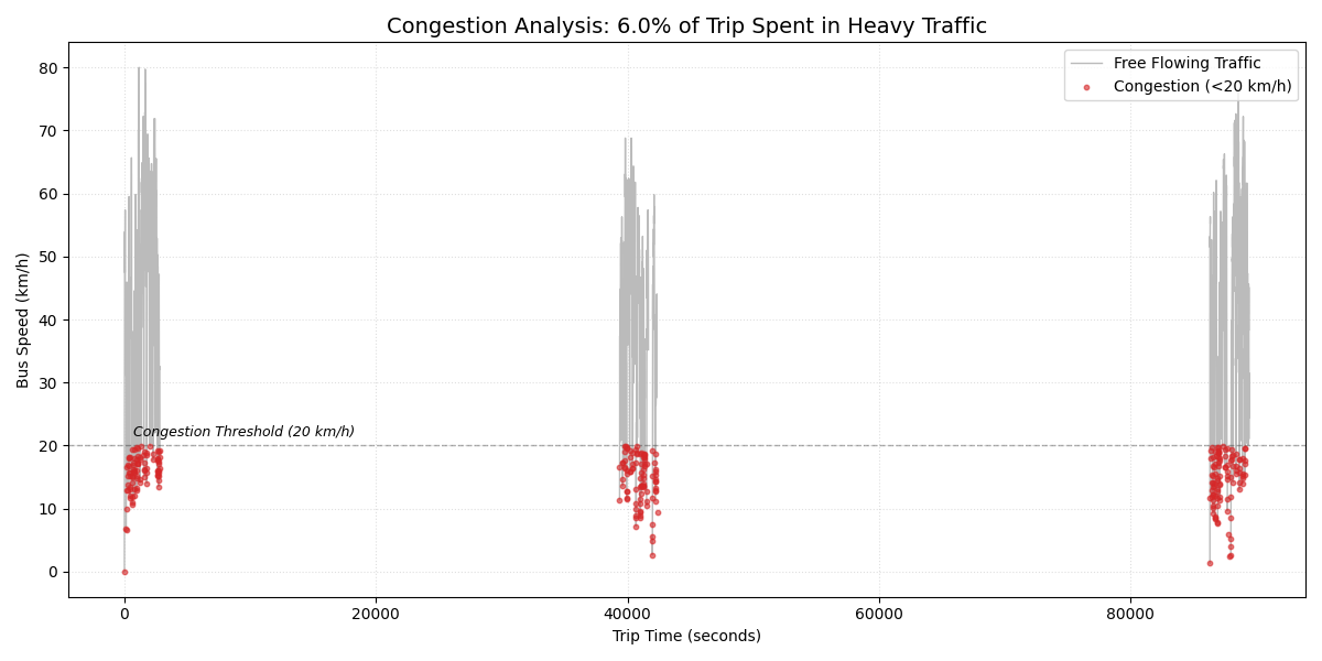
Figures shown here reproduce the existing project outputs and captions. See the technical report for the method and assumptions.
02 / REPRODUCIBLE METHOD
The workflow converts timestamped location records into speed profiles, applies the project’s optimization approach, and presents comparable results.
GPS location records capture timestamped bus movement across the selected routes.
The existing Python scripts clean the recordings and create comparable speed profiles.
The project applies its hybrid MMAS-ABC approach to generate optimized driving cycles.
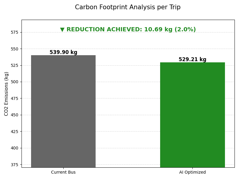
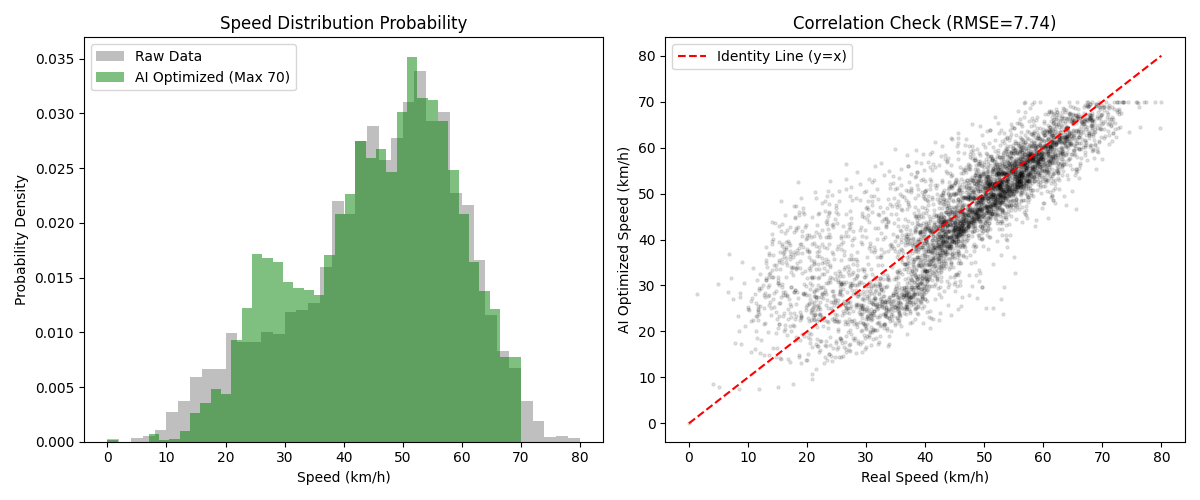
Five result views per dataset show cycles, congestion, emissions, and validation.
Study whether smoother bus driving cycles can reduce unnecessary speed variation, improve operating efficiency, and support more sustainable urban transport planning.
03 / RESEARCH OUTPUTS
Five Ahmedabad–Gandhinagar datasets and two Bengaluru BMTC traces provide the project’s real-world movement data.
Python processing scripts produce bus cycles and apply the project’s MMAS–ABC optimization workflow.
Thirty-five charts present optimized cycles, congestion, emissions comparisons, and validation across all seven datasets.
04 / PUBLICATIONS
Read the complete methodology, review the research paper, download the presentation, or view the project poster.
RV COLLEGE OF ENGINEERING